|
Physical Geography
The physical geography of the Upper Zambezi Valley (western and north-western Zambia, south-eastern Angola, the north-eastern Caprivi (Zambezi) panhandle
region of Namibia, and northern Botswana is dominated by the evolving Upper Zambezi (UZ) river system and, to the west, the Okavango-Cuito river system
occupying the northern part of the Kalahari Basin. Together these are often known as the Zambezi-Okavango (or vice-versa) system as they are close related
in terms of historical evolution. The UZ river valley basin extends southwards from the Zambezi-Congo watershed and west-east from the central and southern
Angolan highlands and is bounded eastwards by the Kalomo-Lusaka ridge and by the plateau uplands of central Zambia.
The Zambezi source is said to be in the north western extremity of Zambia, around 50 km north of Mwinilunga. In truth, like most rivers, there could be
several options for source as it all depends on which tributary one denotes as the main channel. But assuming the NW Zambia source, the stream first flows
west into Angola, then south and back into Zambia at Chavuma, from where it proceeds in a south-south-easterly direction via the Bulozi floodplain and the
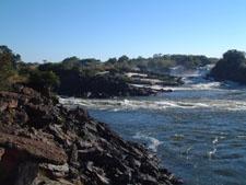
basalt constriction at Ngonye Falls, to Katima Mulilo where it turns eastwards, flowing north of the Chobe or Caprivi floodplain and then to the Victoria
Falls, below which signifies the start of the Middle Zambezi (and from where the river descends to the Indian Ocean). During this trajectory the Upper
Zambezi is joined from the west by the tributaries that supply the largest contributions of water, the Luena (northern version wholly in Angola),
Lungwebungu, and Luanginga (also bringing the waters of the Northern Lueti) and from the east by the Kabompo and southern Luena (the latter eastern side
providing much lesser input). Figure 1 provides a locational map that sites the Upper Zambezi within the context of central southern Africa.

Figure 1. An approximate view of the extent of the Upper Zambezi Basin - area bounded by black line (adapted from Eric
Gaba, Wikipedia Commons - for enhanced original image, click here
|
|
The principal tributaries to the basin, then, are those that originate in the Angolan highlands to the west, most especially the Lungwebungu whose
confluence with the Zambezi lies a few km to the north of Lukulu. This confluence has also, hitherto, been perceived as the northern extremity of the main
Bulozi floodplain. However, the Bulozi floodplain also extends headwards along the river valleys of the Luena, Lungwebungu and Luanginga. Not to be
excluded from these tributaries that originate in the Angolan highlands is the Cuando, a river that contributes comparatively little water and flow to the
UZ yet whose own trajectory and unique characteristics contribute much to the geomorphology of the UZB. These tributaries descend rapidly from the source
regions at around 1600m (the central Angolan highlands rise to a maximum height of 1750m above sea level) to a much lower gradient plain zone in south east
Angola. This gradient becomes even more gentle as the Angolan tributaries and the Zambezi main channel enter the Kalahari Basin. From Chavuma, close to the
Angola-Zambia border to the Victoria Falls the level of the basin is very uniform, the channel of the Zambezi dropping only by 180 metres (590 ft) over a
distance of around 800 kilometres (500 mi). Figure 2 displays the dendritic complexity of the Zambezi-Okavango system. While this is a sylised illustration,
it does provide an idea of the concentration and density of the stream network of the UZB.

Figure 2. Dendritic complexity of the Upper Zambezi Basin (Zambezi-Okavango linked systems) (from Mendohlson 1997)
|
Historical geomorphology of the landscape narrates that the rivers of the Upper Zambezi Basin including the Okavango, Cuando-Linyanti-Chobe, Zambezi
(Upper), Kafue and Luangwa all originally flowed directly south into the Kalahari ‐ the Zambezi flowing into the palaeo-Lake Makgadikgadi, today an
enormous salt pan in NE Botswana - and from there most likely into the Limpopo which today is a relatively small stream flowing through a large valley,
presumably carved out by a much larger river than at present. Tectonic uplift of the land between the Limpopo and Zambezi systems combined with back-cutting
of what is now the Middle Zambezi involved capture first of the Luangwa and Kafue then the Upper Zambezi and Cuando-Chobe. The Kalahari Basin itself is an
endorheic basin encompassing the Okavango system which is connected to the Cuando and therefore to the Zambezi system by the Magwekana or Selinda Spillway.
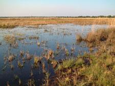
Bulozi floodplain - evolution
The floodplain proper stretches from the confluence of the Zambezi with the Kabompo and Lungwebungu Rivers in the north, to a point about 230 km south,
above the Ngonye falls and south of Senanga. Along most of its length its width is over 30 km, reaching 50 km at the widest, just north of Mongu, principal
town of the plain, situated at its edge. The main body of the plain covers about 5500 km2, but the maximum flooded area is 10 750
km2 when the floodplains of several tributaries are taken into account, such as the Northern Luena (Angola), Lungwebungu and Luanginga all of
which have floodplains headwards of but adjoining the Bulozi floodplain. The Bulozi floodplain acts a giant phreatic zone store (Winsemius et al 2006)
overtopped with a vadose sponge-like sand and silt layer.
The history of the Upper Zambezi is fairly recent at least in geological terms and the evolution of the Bulozi floodplain even more so. It is almost
certain that the floodplain spent a considerable period of time ‐ 140,000 to 300,000 years as a giant swampy lake, bounded in the south by ferricrete bars
which formed as a bi-product of NE-SW upwarping. A short chronology of the Upper Zambezi Valley gives some perspective of the history of the river and
Bulozi floodplain in historical context.
- The Upper Zambezi (UZ) and the Kafue flowed SSE into the Kalahari Basin, and on into the Limpopo system, emptying into the Indian Ocean during the
Cretaceous period (145 to 65 million years ago).
- In the late Palaeogene (Tertiary) period (around 25 million years ago), the Palaeo-Limpopo drainage system is disrupted by lithospheric flexure
(literally bending up of the earth's crust, also called epeirogenic movement) along an axis called the Okavango-Kalahari-Zimbabwe (OKZ) axis (Moore 1999)
or Kalahari-Rhodesian axis (Du Toit 1933) and the Limpopo loses the input of the Okavango and Zambezi which now become endorheic rivers emptying water and
sediment into the Kalahari Basin which is when the Palaeo-Lake Makgadikgadi (PLM) may have started to form.
- In the late Pliocene-early Pleistocene (3 to 2.5 million years ago), the Middle Zambezi (MZ) beheads (captures) the UZ while the Cuando and
Okavango-Cuito system continue to flow into the Kalahari Basin, thereby reducing the level of the PLM as a result of the loss of the waters of the UZ.
- Uplift caused by the Chobe fault disturbs the flow of the UZ and redirects it again into the Kalahari in endorheic fashion, once again supplying
the PLM. Meanwhile, uplift along the Linyanti fault causes the Cuando to cease flowing SE into the Kalahari and diverts to NE at the Linyanti Swamp to join
the UZ at Kazungula.
- In the mid Pleistocene, between 0.7 and 1.25 million years ago, the UZ incised the Sioma Horst ‐ this is probably now superfluous to the
chronology.
To be continued
References
Du Toit, A.L. (1933) 'Crustal movements as a factor in the geographical evolution of South Africa,' South African Geographical Journal, 16, 1-33.
Mendohlson, J. and Roberts, C. (1997) An environmental profile and atlas of Caprivi, Gamsberg Macmillan, Windhoek, Namibia.
Moore A.E. (1999) 'A reappraisal of epeirogenic flexure axes in southern Africa' South African Journal of Geology, 102, 363-376
Winsemius, H.C. et al (2006) 'Comparison of two model approaches in the Zambezi river basin with regard to model reliability and identifiability'
Hydrology and Earth System Sciences 10, 339-352.
Political Geography (Under construction)
The history of human settlement in the Upper Zambezi Valley can be traced back at
least to the Middle and Later Stone Age which we know from archaeological excavations near to Sioma and elsewhere that rocky outcrops perforate the
thick Kalari sand mantle that covers the valley.
Today, Western Province which includes much of the area also known as Barotseland, is one the most densely populated regions of rural
Zambia. However, this population density varies widely today as it
has over the centuries although for different reasons. As will be seen from the map in Figure 1 below (click on the map for larger image),
much of present-day settlement is clustered on the ridge that forms the eastern
escarment of the Bulozi floodplain which is also the location for the largest town and provincial capital, Mongu (population approx. 160,000) and Senanga.

Figure 1: Land use map of Barotseland from 1954
Click on image to enlarge
Logistical information
Mongu is connected with the Zambian capital Lusaka by a tarred road (M9), one of the few in the province
that is tarred, along which most
supplies for Western Province flow in and most goods produced (nearly all agricultural), flow out. This raod has recently been extended across the Bulozi
floodplain to Kalabo. A slowly increasing volume of goods now permeate from
Namibia via the border post at Katima. This supply relies on a road between Senanga and the Namibian
border post at Wenela which has been recently tarred and refurbished with a new bridge over the Zambezi at Sioma that replaced an earlier pontoon crossing at Kalongola and
makes the raod usable throughout the year. Throughput
of goods and trade to and from Angola which forms a
substantial part of the Zambian border to the west and north of Western Province is, by comparison, negligible. Following the peace treaty negotiated in
2002 that ended the Angolan civil war, relations between Zambia and Angola have stabilised and improved after a period of strain and a consulate of the Republic
of Angola exists in Mongu.
However, while cultural affinty has long extended from Barotseland well into modern-day Angola, the absence of a tarred road represents a perpetual hindrance to
communications. There is a plan to connect the Lusaka-Mongu-Kalabo highway
(with an improved road to Sikongo on the Angolan border) with a road to be built by Angola eventually connecting to the Atlantic
coast at Benguella. However, as of 2020, the track beyond Sikongo remains difficult to ascertain with deep sand and is not recommended. There is also
a track that extends from the Zambian border post at Shangombo to the border with Angola but this is also difficult to navigate and liable to flooding
from the River Cuando and has an equally poor road connection on the Angolan side.
Bus services currently connect the Inter-city terminus on the Dedan Kimathi Road in Lusaka with Kaoma, Mongu, Senanga and Kalabo. Journey time from Lusaka to Mongu
(approx 600 km) can vary between 6 and 9 hours depending on road and vehicle conditions. Other bus services connect Mongu to Sioma, Sesheke, Mwandi and Livingstone while
minibus taxis connect Mongu to Kalabo and Limulunga. River transport offers connections from the new Zambezi bridge (between Mongu and Kalabo) and Libonda.
As of October 2020, the M9 road between the Kafue National
Park western gate to Kaoma and beyond as far as the Lukulu turn, is somewhat degraded and requires considerable care and attention by drivers of all types of vehicle.
The Livingstone-Sesheke road in the south of the province is also in a poor condition between Kazungula - where a new bridge across the Zambezi connecting Zambia with
Botswana has recently been completed - and Sesheke, having been degraded by heavy truck use.
|


